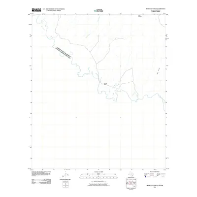
2010 Map of Bramlett Ranch
USGS Topo · Published 2010About this map
The Rio Grande carves a meandering international border across this landscape, dividing the United States and Mexico at the turn of the 21st century. The terrain is defined by dry watercourses and sharp relief, with drainage systems like Squaw Creek feeding toward the river valley from the north. Settlement is sparse, anchored primarily by the Bramlett Ranch, which sits near the river's edge in a remote stretch of the borderlands.
Find a feature on this map
6 named features on this map. Tap any name to fly to it.
Don’t see what you’re looking for? This feature index may not catch every label — zoom into the map to look around manually.
Map Details
Editions of this 2010 Bramlett Ranch Map
This is the sole edition of this map. No revisions or reprints were ever made.
Other maps of this area

1892 · Chispa
USGS Topo · 1:125,000

1895 · Chispa
USGS Topo · 1:125,000

1897 · Eagle Mountain
USGS Topo · 1:125,000

1897 · Chispa
USGS Topo · 1:125,000

1916 · Eagle Mountain
USGS Topo · 1:125,000

1959 · Marfa
USGS Topo · 1:250,000

1965 · Marfa
USGS Topo · 1:250,000
1972 · Lobo SW
USGS Topo · 1:24,000
1972 · Bramlett Ranch
USGS Topo · 1:24,000
1972 · Mesquite Spring
USGS Topo · 1:24,000