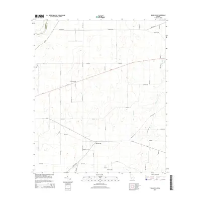
2014 Map of Branchville
USGS Topo · Published 2014About this map
Branchville and Greenwood anchor this part of Southwest Georgia, where the land begins to drain toward the Flint River along the Baker and Mitchell County line. The geography is defined by a series of depressions and slow-moving watercourses, most notably the Medicine Sink and the winding path of Big Slough. This landscape is reflected in the local road names, which carry hints of regional flora and agricultural history, such as Sassafras Tea Rd, Longleaf Rd, and Wiregrass Rd.
Find a feature on this map
46 named features on this map. Tap any name to fly to it.
Don’t see what you’re looking for? This feature index may not catch every label — zoom into the map to look around manually.
Map Details
Editions of this 2014 Branchville Map
This is the sole edition of this map. No revisions or reprints were ever made.
Other maps of this area

1953 · Dothan
USGS Topo · 1:250,000

1954 · Dothan
USGS Topo · 1:250,000

1955 · Dothan
USGS Topo · 1:250,000

1956 · Baconton
USGS Topo · 1:62,500

1956 · Newton
USGS Topo · 1:62,500

1971 · Gee Pond
USGS Topo · 1:24,000

1971 · Vada
USGS Topo · 1:24,000

1971 · Camilla
USGS Topo · 1:24,000
1971 · Pelham
USGS Topo · 1:24,000

1971 · Hopeful
USGS Topo · 1:24,000