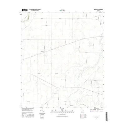
2017 Map of Branchville
USGS Topo · Published 2017About this map
Branchville and Greenwood anchor this survey of the Georgia coastal plain where the border of Baker Co and Mitchell Co meets the Flint River. The landscape is defined by its subtle drainage patterns and unique geological depressions, most notably the prominent Medicine Sink and the winding course of Big Slough. A dense network of rural routes, many bearing evocative family or botanical names like Sassafras Tea Rd, Baggs Ferry Rd, and Cool Breeze Rd, reveals a legacy of local agricultural connectivity and river access. For those researching family ties, the Turkey Pen Cem remains a significant cultural landmark south of the primary settlement at Branchville. This 2017 edition details the modern road alignments and hydrologic features as they appeared in the early 21st century.
Find a feature on this map
43 named features on this map. Tap any name to fly to it.
Don’t see what you’re looking for? This feature index may not catch every label — zoom into the map to look around manually.
Map Details
Editions of this 2017 Branchville Map
This is the sole edition of this map. No revisions or reprints were ever made.
Other maps of this area

1953 · Dothan
USGS Topo · 1:250,000

1954 · Dothan
USGS Topo · 1:250,000

1955 · Dothan
USGS Topo · 1:250,000

1956 · Baconton
USGS Topo · 1:62,500

1956 · Newton
USGS Topo · 1:62,500

1971 · Gee Pond
USGS Topo · 1:24,000

1971 · Vada
USGS Topo · 1:24,000

1971 · Camilla
USGS Topo · 1:24,000
1971 · Pelham
USGS Topo · 1:24,000

1971 · Hopeful
USGS Topo · 1:24,000