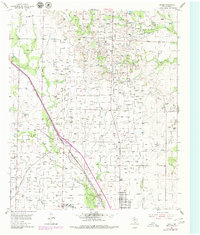
1954 Map of Brand
USGS Topo · Published 1980About this map
The industrial footprint of the Kelly-Snyder Field dominates this West Texas landscape, revealing a dense network of pipelines and petroleum infrastructure as it stood in the mid-1950s. The settlement of Brand serves as a central point along the Panhandle and Santa Fe railroad line, which cuts diagonally across the terrain. Evidence of earlier transport persists through an Old Railroad Grade and numerous caliche pits scattered across the plains.
Find a feature on this map
21 named features on this map. Tap any name to fly to it.
Don’t see what you’re looking for? This feature index may not catch every label — zoom into the map to look around manually.
Map Details
Editions of this 1954 Brand Map
2 editions found
Other maps of this area

1952 · Snyder
USGS Topo · 1:24,000

1952 · Ira NE
USGS Topo · 1:24,000

1952 · Hermleigh
USGS Topo · 1:24,000

1954 · Lloyd Mountain
USGS Topo · 1:24,000

1954 · Dermott
USGS Topo · 1:24,000

1954 · Brand
USGS Topo · 1:24,000

1954 · Big Spring
USGS Topo · 1:250,000

1958 · Big Spring
USGS Topo · 1:250,000

1969 · Maverick Creek
USGS Topo · 1:24,000

1969 · Flat Top Mountain
USGS Topo · 1:24,000