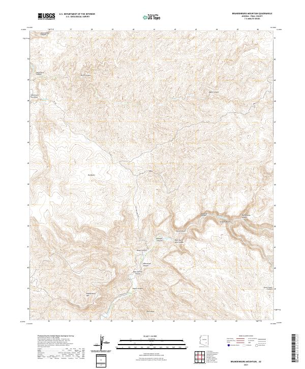
2021 Map of Brandenburg Mountain
USGS Topo · Published 2021About this map
Aravaipa Cr carves a deep path through this Pinal County landscape, defining the character of the terrain south of Brandenburg Mtn. The map reveals a high concentration of drainage systems and named geological formations, such as the dramatic Hells Half Acre Canyon and the surrounding Aravaipa Canyon. In the northern section, the prominent Eskiminzin Fort Rock stands near Eskiminzin Spring, highlighting the intersection of desert water sources and distinctive landmarks.
Find a feature on this map
29 named features on this map. Tap any name to fly to it.
Don’t see what you’re looking for? This feature index may not catch every label — zoom into the map to look around manually.
Map Details
Editions of this 2021 Brandenburg Mountain Map
This is the sole edition of this map. No revisions or reprints were ever made.
Other maps of this area

1911 · Winkelman
USGS Topo · 1:125,000

1913 · Winkelman
USGS Topo · 1:125,000

1915 · Christmas
USGS Topo · 1:62,500

1917 · Christmas
USGS Topo · 1:62,500

1938 · Klondyke
USGS Topo · 1:48,000

1943 · Klondyke
USGS Topo · 1:62,500

1949 · Holy Joe Peak
USGS Topo · 1:62,500

1949 · Saddle Mtn.
USGS Topo · 1:24,000

1949 · Brandenburg Mtn
USGS Topo · 1:24,000
1949 · Holy Joe Peak
USGS Topo · 1:24,000