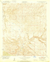
1950 Map of Brandenburg Mtn
USGS Topo · Published 1950About this map
Aravaipa Creek winds through the southern reaches of this Pinal County landscape, serving as the primary corridor for a series of family-held properties and remote outposts. The 1950 terrain is defined by its canyon systems and isolated ranching sites, including Painted Cave Ranch, Wagner Ranch, and La Jolla Ranch. These named places, alongside Hortons Place and Lewis Ranch, suggest a reliance on the canyon bottoms for water and passage through the complex topography of the Brandenburg Mtn area.
Find a feature on this map
29 named features on this map. Tap any name to fly to it.
Don’t see what you’re looking for? This feature index may not catch every label — zoom into the map to look around manually.
Map Details
Editions of this 1950 Brandenburg Mtn Map
This is the sole edition of this map. No revisions or reprints were ever made.
Other maps of this area

1911 · Winkelman
USGS Topo · 1:125,000

1913 · Winkelman
USGS Topo · 1:125,000

1915 · Christmas
USGS Topo · 1:62,500

1917 · Christmas
USGS Topo · 1:62,500

1938 · Klondyke
USGS Topo · 1:48,000

1943 · Klondyke
USGS Topo · 1:62,500

1949 · Holy Joe Peak
USGS Topo · 1:62,500

1949 · Saddle Mtn.
USGS Topo · 1:24,000

1949 · Brandenburg Mtn
USGS Topo · 1:24,000
1949 · Holy Joe Peak
USGS Topo · 1:24,000