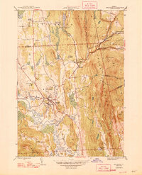
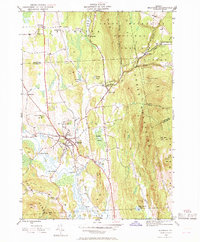
1946 Map of Brandon
USGS Topo · Published 1946About this map
Otter Creek meanders through the western lowlands, defined by broad floodplains and crossings like Sanderson Bridge and Dean Bridge. This mid-century landscape is dominated by the industrial and social hub of Brandon, where the Rutland railroad tracks run parallel to the Neshobe River. To the east, the terrain rises sharply into the Green Mountain National Forest, where labels such as Lead Mine Mtn and Proctor Lookout hint at the area's history of resource extraction and fire observation.
Find a feature on this map
56 named features on this map. Tap any name to fly to it.
Don’t see what you’re looking for? This feature index may not catch every label — zoom into the map to look around manually.
Map Details
Editions of this 1946 Brandon Map
6 editions found
Other maps of this area

1891 · Rutland
USGS Topo · 1:62,500

1893 · Rutland
USGS Topo · 1:62,500

1895 · Castleton
USGS Topo · 1:62,500

1897 · Castleton
USGS Topo · 1:62,500

1902 · Brandon
USGS Topo · 1:62,500

1904 · Brandon
USGS Topo · 1:62,500

1915 · Rochester
USGS Topo · 1:62,500

1917 · Rochester
USGS Topo · 1:62,500

1920 · Brandon
USGS Topo · 1:62,500
1943 · Cornwall
USGS Topo · 1:31,680