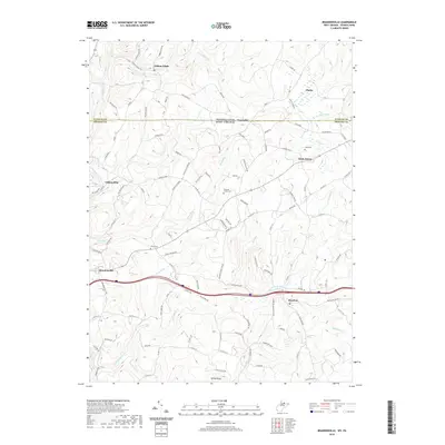
2019 Map of Brandonville
USGS Topo · Published 2019About this map
The Pennsylvania West Virginia state line bisects this quadrangle, where the border between Fayette and Preston counties defines a landscape of high glades and winding creeks. Settlement patterns follow the valley floor of Big Sandy Creek, particularly around the historic hub of Clifton Mills and the nearby town of Brandonville. The map captures a high degree of local family-named infrastructure, with roads like Maust Rd, Rishel Rd, and George Maust reflecting deep-rooted landownership. Small community anchors are found throughout the hills, including Union Cem and Teets Cem. The southern reach is dominated by Kelley Knob, while the northern portion transitions into the wetlands known simply as the Glades. This detailed survey of the 2010s shows the persistent rural character of the region, where waterways like Glade Run and Little Sandy Creek remain the primary geographical dividers between dispersed mountain hamlets.
Find a feature on this map
113 named features on this map. Tap any name to fly to it.
Don’t see what you’re looking for? This feature index may not catch every label — zoom into the map to look around manually.
Map Details
Editions of this 2019 Brandonville Map
This is the sole edition of this map. No revisions or reprints were ever made.
Other maps of this area

1900 · Accident
USGS Topo · 1:62,500

1900 · Uniontown
USGS Topo · 1:62,500

1904 · Bruceton
USGS Topo · 1:62,500

1922 · Confluence
USGS Topo · 1:62,500

1926 · Bruceton
USGS Topo · 1:62,500

1931 · Uniontown
USGS Topo · 1:62,500

1931 · Confluence
USGS Topo · 1:62,500

1931 · Bruceton Mills
USGS Topo · 1:62,500

1933 · Confluence
USGS Topo · 1:62,500

1933 · Bruceton
USGS Topo · 1:62,500