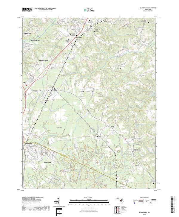
2023 Map of Brandywine
USGS Topo · Published 2023About this map
Zekiah Swamp Run and Mattawoman Creek define the low-lying drainage patterns of this southern Maryland landscape, where the borders of Prince George'S Co and Charles Co meet. The area is characterized by a high density of small rural communities and family-associated landmarks, including North Keys, Horsehead, and Ashbox. Genealogists will find a significant concentration of burial sites, ranging from large installations like the Maryland Veterans Cem to smaller parish and family plots such as Boones Catholic Chapel Cem and the Connick Family Cem.
Find a feature on this map
168 named features on this map. Tap any name to fly to it.
Don’t see what you’re looking for? This feature index may not catch every label — zoom into the map to look around manually.
Map Details
Editions of this 2023 Brandywine Map
This is the sole edition of this map. No revisions or reprints were ever made.
Other maps of this area

1892 · Prince Frederick
USGS Topo · 1:62,500

1892 · Brandywine
USGS Topo · 1:62,500

1892 · Owensville
USGS Topo · 1:62,500

1895 · Prince Frederick
USGS Topo · 1:62,500

1895 · Brandywine
USGS Topo · 1:62,500

1895 · Owensville
USGS Topo · 1:62,500

1899 · Patuxent
USGS Topo · 1:125,000

1900 · Washington
USGS Topo · 1:62,500

1901 · Prince Frederick
USGS Topo · 1:62,500

1905 · Owensville
USGS Topo · 1:62,500