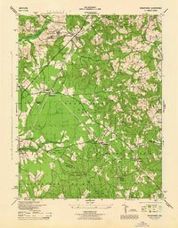
1944 Map of Brandywine
USGS Topo · Published 1944About this map
The Cheltenham School for Boys and the nearby USC & GS Mag Observatory anchor the northern landscape of this Prince George's County survey, which reveals a transition from managed forests to emerging rail-side settlements. The Pennsylvania railroad line cuts diagonally through Brandywine, connecting scattered communities like Brandywine Heights and Townshend. Further south, the vast expanse of the Cedarville State Forest straddles the line between Prince Georges Co and Charles Co, where the headwaters of Mattawoman Creek and Butlers Branch define the drainage patterns. Smaller hamlets such as Horsehead, Ashbox, and Orme are characterized by their local institutions, including St Pauls Ch and several small rural schools. A dedicated Cedar Point (U S Navy) road and the U S Naval Reservation reflect the significant military and government footprint in this region during the mid-1940s.
Find a feature on this map
48 named features on this map. Tap any name to fly to it.
Don’t see what you’re looking for? This feature index may not catch every label — zoom into the map to look around manually.
Map Details
Editions of this 1944 Brandywine Map
This is the sole edition of this map. No revisions or reprints were ever made.
Other maps of this area

1892 · Prince Frederick
USGS Topo · 1:62,500

1892 · Brandywine
USGS Topo · 1:62,500

1892 · Owensville
USGS Topo · 1:62,500

1895 · Prince Frederick
USGS Topo · 1:62,500

1895 · Brandywine
USGS Topo · 1:62,500

1895 · Owensville
USGS Topo · 1:62,500

1899 · Patuxent
USGS Topo · 1:125,000

1900 · Washington
USGS Topo · 1:62,500

1901 · Prince Frederick
USGS Topo · 1:62,500

1905 · Owensville
USGS Topo · 1:62,500