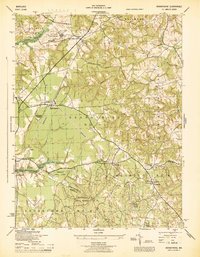
1945 Map of Brandywine
USGS Topo · Published 1945About this map
Cheltenham School for Boys and the extensive Cedarville State Forest define this 1940s landscape in southern Prince George's County. The era's institutional and military presence is evident at the US Naval Reservation and the nearby USC & GS Mag Observatory. Settlement patterns cluster around the Popes Creek Branch of the railroad, which services the community of Brandywine and its surrounding heights.
Find a feature on this map
49 named features on this map. Tap any name to fly to it.
Don’t see what you’re looking for? This feature index may not catch every label — zoom into the map to look around manually.
Map Details
Editions of this 1945 Brandywine Map
This is the sole edition of this map. No revisions or reprints were ever made.
Other maps of this area

1892 · Prince Frederick
USGS Topo · 1:62,500

1892 · Brandywine
USGS Topo · 1:62,500

1892 · Owensville
USGS Topo · 1:62,500

1895 · Prince Frederick
USGS Topo · 1:62,500

1895 · Brandywine
USGS Topo · 1:62,500

1895 · Owensville
USGS Topo · 1:62,500

1899 · Patuxent
USGS Topo · 1:125,000

1900 · Washington
USGS Topo · 1:62,500

1901 · Prince Frederick
USGS Topo · 1:62,500

1905 · Owensville
USGS Topo · 1:62,500