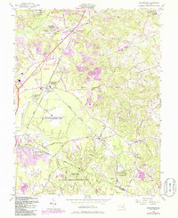
1956 Map of Brandywine
USGS Topo · Published 1986About this map
Brandywine and its surrounding rural Maryland landscape appear here as a complex mix of agricultural land and sensitive government installations during the mid-20th century. The presence of the U S Military Reservation Globecom Radio Receiving Station and the U S Naval Reservation highlights the region's strategic importance for defense and communication. These sprawling facilities sit alongside established community landmarks like Cheltenham, Baden, and the Boys Village of Maryland.
Find a feature on this map
81 named features on this map. Tap any name to fly to it.
Don’t see what you’re looking for? This feature index may not catch every label — zoom into the map to look around manually.
Map Details
Editions of this 1956 Brandywine Map
4 editions found
Other maps of this area

1892 · Prince Frederick
USGS Topo · 1:62,500

1892 · Brandywine
USGS Topo · 1:62,500

1892 · Owensville
USGS Topo · 1:62,500

1895 · Prince Frederick
USGS Topo · 1:62,500

1895 · Brandywine
USGS Topo · 1:62,500

1895 · Owensville
USGS Topo · 1:62,500

1899 · Patuxent
USGS Topo · 1:125,000

1900 · Washington
USGS Topo · 1:62,500

1901 · Prince Frederick
USGS Topo · 1:62,500

1905 · Owensville
USGS Topo · 1:62,500