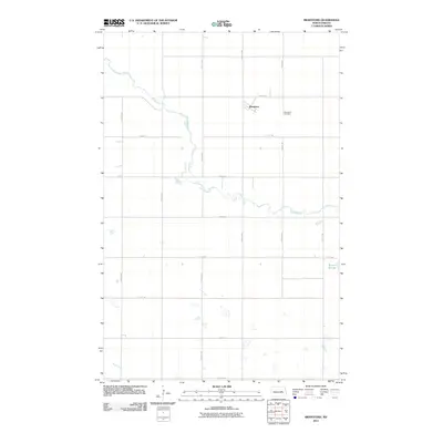
2011 Map of Brantford
USGS Topo · Published 2011About this map
The James River snakes through the glacial till of Eddy County, carving a winding path across this rural landscape near the start of the 21st century. At the heart of the region lies the small community of Brantford, established along a grid of section-line roads that define the agricultural character of the North Dakota plains. The map reveals a high concentration of prairie potholes and wetlands typical of the region, including the larger Rusten Slough to the southeast and the drainage of Kelly Creek in the southwest corner. For those tracing family ties to this portion of the state, the Brantford Cemetery remains a significant anchor, situated east of the primary settlement. The sparse infrastructure, consisting largely of numbered avenues and streets like 75th Ave NE and 12th St NE, illustrates the enduring rural isolation and the vast scale of the surrounding farmland.
Find a feature on this map
18 named features on this map. Tap any name to fly to it.
Don’t see what you’re looking for? This feature index may not catch every label — zoom into the map to look around manually.
Map Details
Editions of this 2011 Brantford Map
This is the sole edition of this map. No revisions or reprints were ever made.
Other maps of this area

1900 · Pingree
USGS Topo · 1:125,000

1944 · Brantford
USGS Topo · 1:62,500

1946 · Brantford
USGS Topo · 1:62,500

1948 · New Rockford
USGS Topo · 1:62,500

1948 · Carrington
USGS Topo · 1:62,500

1949 · Grace City
USGS Topo · 1:24,000

1950 · Carrington East
USGS Topo · 1:24,000

1950 · New Rockford NE
USGS Topo · 1:24,000

1950 · Brantford NW
USGS Topo · 1:24,000

1950 · Grace City
USGS Topo · 1:24,000