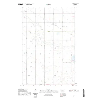
2020 Map of Brantford
USGS Topo · Published 2020About this map
James River headwaters meander through this prairie landscape on the border of Eddy and Foster counties. The small settlement of Brantford serves as the local hub, situated where Railroad Ave and Co Rd 10 converge. This area reflects the enduring grid of the Public Land Survey System, with a network of section-line roads like 74th Ave NE and 12th St NE providing access to the surrounding farmstead tracts. Genealogy researchers will find significant landmarks at the Brantford Cem and the Kvernes Lutheran Church Cem, which stand as markers of the region's Scandinavian heritage and early rural community life. To the southeast, the terrain softens into the depressions of Rusten Slough, illustrating the characteristic pothole topography of the North Dakota plains.
Find a feature on this map
25 named features on this map. Tap any name to fly to it.
Don’t see what you’re looking for? This feature index may not catch every label — zoom into the map to look around manually.
Map Details
Editions of this 2020 Brantford Map
This is the sole edition of this map. No revisions or reprints were ever made.
Other maps of this area

1900 · Pingree
USGS Topo · 1:125,000

1944 · Brantford
USGS Topo · 1:62,500

1946 · Brantford
USGS Topo · 1:62,500

1948 · New Rockford
USGS Topo · 1:62,500

1948 · Carrington
USGS Topo · 1:62,500

1949 · Grace City
USGS Topo · 1:24,000

1950 · Carrington East
USGS Topo · 1:24,000

1950 · New Rockford NE
USGS Topo · 1:24,000

1950 · Brantford NW
USGS Topo · 1:24,000

1950 · Grace City
USGS Topo · 1:24,000