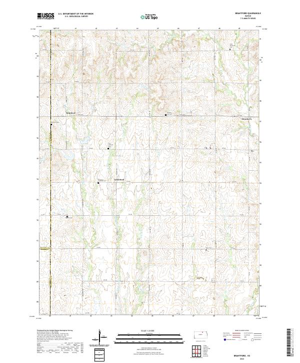
2022 Map of Brantford
USGS Topo · Published 2022About this map
The small rural communities of Brantford, Calderhead, and Strawberry anchor this landscape along the border of Washington, Republic, and Cloud Counties. The area is defined by a dense network of country roads including Bismark Rd and Concord Rd, which follow the section lines of the township and range survey system. Agricultural history is deeply etched into the land through numerous religious and family burial grounds, such as Saint Bernards Cem, Zion Lutheran Cem, and the Brantford Covenant Cem. Waterways like Scribner Cr and its W Br Scribner Cr cut through the terrain, influencing the placement of early homesteads. The concentration of seven distinct cemeteries in this small radius suggests a series of tight-knit pioneer settlements that once flourished along these creek beds.
Find a feature on this map
49 named features on this map. Tap any name to fly to it.
Don’t see what you’re looking for? This feature index may not catch every label — zoom into the map to look around manually.
Map Details
Editions of this 2022 Brantford Map
This is the sole edition of this map. No revisions or reprints were ever made.
Other maps of this area

1893 · Washington
USGS Topo · 1:125,000

1955 · Manhattan
USGS Topo · 1:250,000

1956 · Manhattan
USGS Topo · 1:250,000

1957 · Manhattan
USGS Topo · 1:250,000

1965 · Clifton
USGS Topo · 1:24,000

1965 · Brantford
USGS Topo · 1:24,000
1965 · Clyde
USGS Topo · 1:24,000

1965 · Agenda
USGS Topo · 1:24,000

1966 · Morrowville
USGS Topo · 1:24,000
1966 · Haddam
USGS Topo · 1:24,000