
1957 Map of Brassua Lake
USGS Topo · Published 1967About this map
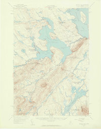
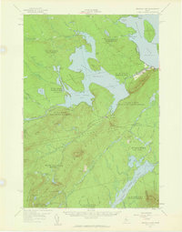
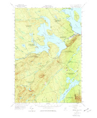
Brassua Lake and its intricate shoreline dominate this mid-century look at Somerset County, where the Moose River feeds a landscape of water and woodland. The village of Rockwood stands on the eastern edge along Moosehead Lake, serving as a focal point with St Josephs Ch, St Josephs Cem, and the Blaine Sch. The map reveals the infrastructure of the wilderness economy, from the Brassua Dam to the remote outposts of Cornish Farm and Milliken Farm. The Canadian Pacific Railroad cuts across the center of the sheet, connecting isolated points like Mackamp, Tarratine, and Somerset Junction. This network reflects an era when rail and river provided the primary access through the townships of Sandwich Academy and Misery, where names like Misery Ridge and Misery Knob speak to the challenging character of the interior Maine woods.
Find a feature on this map
88 named features on this map. Tap any name to fly to it.
Don’t see what you’re looking for? This feature index may not catch every label — zoom into the map to look around manually.
Map Details
Editions of this 1957 Brassua Lake Map
5 editions found

Other maps of this area

1905 · The Forks
USGS Topo · 1:62,500

1907 · The Forks
USGS Topo · 1:62,500

1920 · Moosehead Lake
USGS Topo · 1:62,500

1921 · Brassua Lake
USGS Topo · 1:62,500

1922 · Moosehead Lake
USGS Topo · 1:62,500

1922 · Long Pond
USGS Topo · 1:62,500

1923 · Brassua Lake
USGS Topo · 1:62,500

1924 · Long Pond
USGS Topo · 1:62,500

1925 · Pierce Pond
USGS Topo · 1:48,000

1927 · Pierce Pond
USGS Topo · 1:62,500
Featured Places
- Misery Gore, ME
- Tomhegan Township, ME
- Sapling Township, ME
- Big Moose Township, ME
- Tarratine, Taunton & Raynham Academy Grant