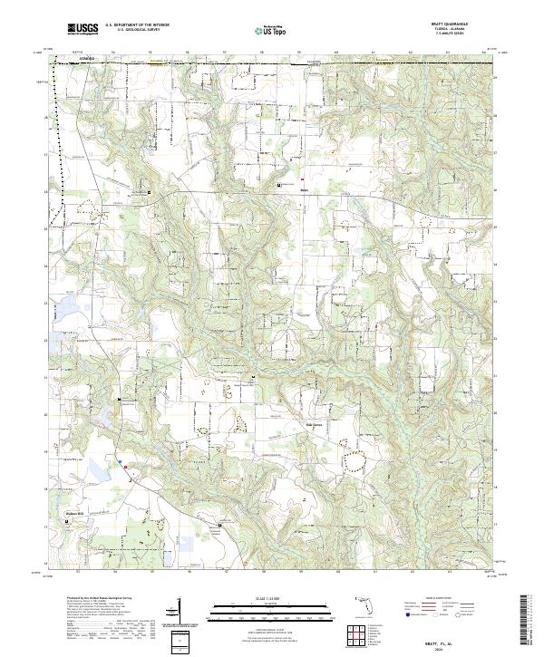
2024 Map of Bratt
USGS Topo · Published 2024About this map
Bratt and the surrounding agricultural landscape of northern Escambia County sit just south of the Alabama-Florida border. This region is defined by its network of winding waterways, including the prominent Pine Barren Creek, Beaverdam Creek, and Canoe Creek. The settlement pattern centers on small community hubs like Oak Grove and Walnut Hill, which are anchored by long-standing spiritual and burial grounds. Genealogists will find interest in the proximity of family and community landmarks such as Big Pine Barren Baptist Church, Godwin Cem, and the Union Primitive Baptist Church located near the headwaters of Little Pine Barren Creek. The road network, including Co Rd 99 and Pine Barren Rd, follows the contours of the drainage basins, connecting the scattered farms and homesteads that have long occupied this corner of the Florida Panhandle.
Find a feature on this map
100 named features on this map. Tap any name to fly to it.
Don’t see what you’re looking for? This feature index may not catch every label — zoom into the map to look around manually.
Map Details
Editions of this 2024 Bratt Map
This is the sole edition of this map. No revisions or reprints were ever made.
Other maps of this area

1941 · Century
USGS Topo · 1:62,500

1942 · Perdido
USGS Topo · 1:62,500

1942 · Dyas
USGS Topo · 1:62,500

1943 · Century
USGS Topo · 1:62,500

1944 · Dyas
USGS Topo · 1:62,500

1944 · Perdido
USGS Topo · 1:62,500

1953 · Andalusia
USGS Topo · 1:250,000

1957 · Andalusia
USGS Topo · 1:250,000

1957 · Pensacola
USGS Topo · 1:250,000

1959 · Pensacola
USGS Topo · 1:250,000