Loading...
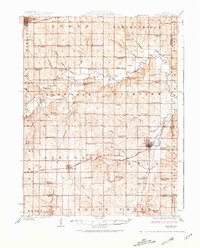
Loading map...1924 Map of Braymer
USGS Topo · Published 1981About this map
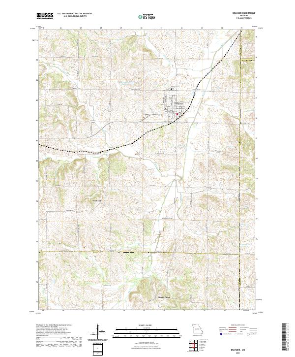
The Chicago Milwaukee and St Paul railroad anchors the southern reaches of this landscape, connecting the agricultural hubs of Cowgill and Braymer during the early 1920s. This survey reveals a high density of rural institutions, with dozens of family-named schools such as Wolf Grove School and Liberty Eagle School serving the farming townships. The terrain is defined by the winding course of Shoal Creek, which is crossed by the Gould Farm Bridge north of Bonanza.
Find a feature on this map
70 named features on this map. Tap any name to fly to it.
Don’t see what you’re looking for? This feature index may not catch every label — zoom into the map to look around manually.
Map Details
Date Portrayed1924
Date Published1981
PublisherU.S. Geological Survey
Map TypeTopographic
Scale1:62,500
Physical Dimensions17.6 x 21.8 inches
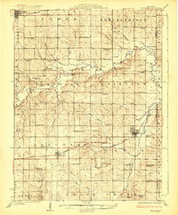
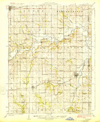
Editions of this 1924 Braymer Map
3 editions found
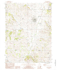
Historical Maps of Hamilton Through Time
6 maps found
Featured Locations
Source Details
SourceU.S. Geological Survey
CopyrightPublic Domain