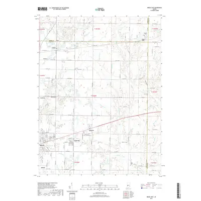
2019 Map of Brazil East
USGS Topo · Published 2019About this map
Brazil and its surrounding Clay County townships appear here at the end of the 2010s, showing a landscape defined by small-town clusters and a network of rural cemeteries. Industrial footprints like Reinoehl Field and the complex drainage of E Fork Birch Cr suggest the area's ongoing relationship with its natural resources. The settlement pattern remains centered on historic hubs like Knightsville, Harmony, and Cardonia, which are interconnected by a rigid grid of county roads such as Rio Grande Rd.
Find a feature on this map
101 named features on this map. Tap any name to fly to it.
Don’t see what you’re looking for? This feature index may not catch every label — zoom into the map to look around manually.
Map Details
Editions of this 2019 Brazil East Map
This is the sole edition of this map. No revisions or reprints were ever made.
Other maps of this area

1908 · Clay City
USGS Topo · 1:48,000

1910 · Clay City
USGS Topo · 1:62,500

1950 · Brazil East
USGS Topo · 1:24,000

1950 · Brazil West
USGS Topo · 1:24,000

1951 · Clinton Falls
USGS Topo · 1:24,000

1951 · Mansfield
USGS Topo · 1:24,000

1952 · Catlin
USGS Topo · 1:24,000

1952 · Reelsville
USGS Topo · 1:24,000

1953 · Indianapolis
USGS Topo · 1:250,000

1956 · Indianapolis
USGS Topo · 1:250,000