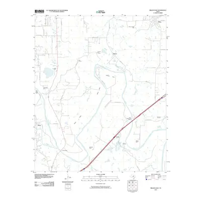
2010 Map of Brazos East
USGS Topo · Published 2010About this map
The Brazos River snakes through the center of this landscape, carving deep oxbows and distinct landforms such as Littlefield Bend, Meeks Bend, and Polk Stalk Bend. This 2010 survey shows the area's agrarian character and long family history, documented through several local burial grounds including the Dominicar Merlo Cemetery and Poe Prairie Cemetery. The settlement of Millsap sits in the northeast corner near the Missouri Pacific Dam, while the community of Brazos is situated to the west. Evidence of older transport routes and valley farming is visible along Dobbs Valley and Gilbert Valley. The modern road network is anchored by the US 281 Bridge and the State Highway 89 Bridge, which facilitate crossings over the wide river channel as it flows toward the southeast corner of the quadrangle.
Find a feature on this map
53 named features on this map. Tap any name to fly to it.
Don’t see what you’re looking for? This feature index may not catch every label — zoom into the map to look around manually.
Map Details
Editions of this 2010 Brazos East Map
This is the sole edition of this map. No revisions or reprints were ever made.
Other maps of this area

1891 · Weatherford
USGS Topo · 1:125,000

1891 · Palo Pinto
USGS Topo · 1:125,000

1893 · Weatherford
USGS Topo · 1:125,000

1918 · Palo Pinto
USGS Topo · 1:125,000

1925 · Palo Pinto 4-b
USGS Topo · 1:48,000

1927 · Mineral Wells
USGS Topo · 1:62,500

1931 · Dennis
USGS Topo · 1:62,500

1931 · Santo
USGS Topo · 1:62,500

1954 · Dallas
USGS Topo · 1:250,000

1954 · Abilene
USGS Topo · 1:250,000