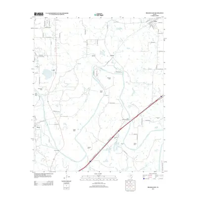
2012 Map of Brazos East
USGS Topo · Published 2012About this map
The Brazos River creates a serpentine landscape of deep loops and named bends in this portion of North Central Texas, shaping the development of Millsap and the surrounding rural communities. These riverine features, such as Littlefield Bend and Polk Stalk Bend, dictated early settlement patterns and the placement of crossings like the State Highway 89 Bridge. The map records several smaller family or community burial grounds including Poe Prairie Cem, Goen Cem, and Grassdale Cem, which remain as touchstones for local genealogical research. Away from the water, the terrain opens into valleys like Dobbs Valley and Gilbert Valley, intersected by the modern corridor of Interstate 20 and remnants of the older Old US Highway 80. This mix of riparian topography and early highway infrastructure defines the transition from historic river crossings to contemporary transport routes.
Find a feature on this map
84 named features on this map. Tap any name to fly to it.
Don’t see what you’re looking for? This feature index may not catch every label — zoom into the map to look around manually.
Map Details
Editions of this 2012 Brazos East Map
This is the sole edition of this map. No revisions or reprints were ever made.
Other maps of this area

1891 · Weatherford
USGS Topo · 1:125,000

1891 · Palo Pinto
USGS Topo · 1:125,000

1893 · Weatherford
USGS Topo · 1:125,000

1918 · Palo Pinto
USGS Topo · 1:125,000

1925 · Palo Pinto 4-b
USGS Topo · 1:48,000

1927 · Mineral Wells
USGS Topo · 1:62,500

1931 · Dennis
USGS Topo · 1:62,500

1931 · Santo
USGS Topo · 1:62,500

1954 · Dallas
USGS Topo · 1:250,000

1954 · Abilene
USGS Topo · 1:250,000