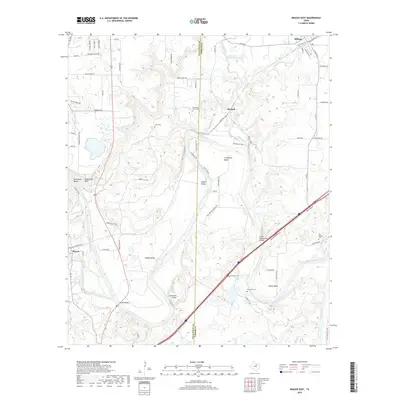
2019 Map of Brazos East
USGS Topo · Published 2019About this map
The Brazos River meanders through this portion of North Texas, defining the landscape where the Palo Pinto and Parker county lines meet. The terrain is characterized by dramatic river bends including Littlefield Bend, Polk Stalk Bend, and Meeks Bend, creating several prominent overlooks such as Inspiration Point. Small rural communities and historical settlements like Millsap, Bennett, and Brazos are connected by a network of farm-to-market roads and local routes like Old River Rd.
Find a feature on this map
77 named features on this map. Tap any name to fly to it.
Don’t see what you’re looking for? This feature index may not catch every label — zoom into the map to look around manually.
Map Details
Editions of this 2019 Brazos East Map
This is the sole edition of this map. No revisions or reprints were ever made.
Other maps of this area

1891 · Weatherford
USGS Topo · 1:125,000

1891 · Palo Pinto
USGS Topo · 1:125,000

1893 · Weatherford
USGS Topo · 1:125,000

1918 · Palo Pinto
USGS Topo · 1:125,000

1925 · Palo Pinto 4-b
USGS Topo · 1:48,000

1927 · Mineral Wells
USGS Topo · 1:62,500

1931 · Dennis
USGS Topo · 1:62,500

1931 · Santo
USGS Topo · 1:62,500

1954 · Dallas
USGS Topo · 1:250,000

1954 · Abilene
USGS Topo · 1:250,000