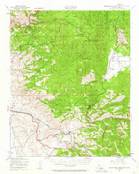
1943 Map of Breckenridge Mtn
USGS Topo · Published 1963About this map
The Southern Pacific Railroad winds through the southern reaches of this Kern County landscape, connecting the small settlements of Bena, Limon, and Caliente as it follows the course of Caliente Creek. This survey, based on 1943 aerial photography, reveals a rugged interior characterized by the transition from the high peaks of Breckenridge Mountain and Mt Adelaide down into the productive Walker Basin. Long-established ranching operations like the Rankin Ranch, Allen Ranch, and White Wolf Ranch are scattered across the terrain, reflecting the area's deep pastoral roots.
Find a feature on this map
47 named features on this map. Tap any name to fly to it.
Don’t see what you’re looking for? This feature index may not catch every label — zoom into the map to look around manually.
Map Details
Editions of this 1943 Breckenridge Mtn Map
4 editions found

Other maps of this area

1906 · Kernville
USGS Topo · 1:125,000

1908 · Kernville
USGS Topo · 1:125,000

1914 · Caliente
USGS Topo · 1:125,000

1915 · Mojave
USGS Topo · 1:125,000

1920 · Delonagha
USGS Topo · 1:62,500

1926 · Glennville
USGS Topo · 1:62,500

1929 · Bena
USGS Topo · 1:31,680

1930 · Bear Mountain
USGS Topo · 1:31,680

1930 · Arvin
USGS Topo · 1:31,680

1931 · Edison
USGS Topo · 1:31,680