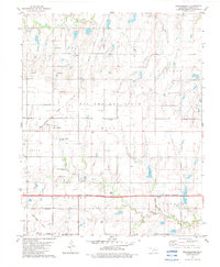
1982 Map of Breckinridge
USGS Topo · Published 1983About this map
The agrarian landscape of Garfield County is defined here by a network of oil and gas fields and the intersection of major rail lines. Breckinridge serves as the primary hub of this rural territory, situated at the junction of the Burlington Northern railroad. Further east, the small community of Cropper sits amidst the gridded fields, typical of the Oklahoma plains in the early 1980s. The terrain is drained by the meanders of Red Rock Creek in the north and Black Bear Creek in the south, which cut through the level topography. Near the southern edge of the survey, the Atchison Topeka and Sante Fe rail corridor passes through, illustrating the historical reliance on these tracks for moving regional energy and agricultural products.
Find a feature on this map
6 named features on this map. Tap any name to fly to it.
Don’t see what you’re looking for? This feature index may not catch every label — zoom into the map to look around manually.
Map Details
Editions of this 1982 Breckinridge Map
This is the sole edition of this map. No revisions or reprints were ever made.
Other maps of this area

1955 · Enid East
USGS Topo · 1:24,000

1955 · Enid
USGS Topo · 1:250,000

1956 · Garber
USGS Topo · 1:62,500

1956 · Enid
USGS Topo · 1:62,500

1958 · Enid
USGS Topo · 1:250,000

1968 · Lamont SE
USGS Topo · 1:24,000

1968 · Hunter
USGS Topo · 1:24,000

1968 · Kremlin
USGS Topo · 1:24,000
1982 · Garber
USGS Topo · 1:24,000
1982 · Enid SE
USGS Topo · 1:24,000