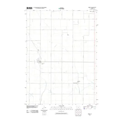
2010 Map of Breda
USGS Topo · Published 2010About this map
Breda and Mount Carmel anchor this rural Carroll County landscape, reflecting the agricultural character of western Iowa. The area is defined by a dense grid of section roads, including Rolland Ave and Kittyhawk Ave, which connect the small farming communities to their regional centers. The Breda Post Office and Auburn Post Office in the north serve as local hubs, while Saint Bernards Cemetery and Our Lady of Mount Carmel Cemetery provide significant points of interest for those researching local family histories.
Find a feature on this map
35 named features on this map. Tap any name to fly to it.
Don’t see what you’re looking for? This feature index may not catch every label — zoom into the map to look around manually.
Map Details
Editions of this 2010 Breda Map
This is the sole edition of this map. No revisions or reprints were ever made.
Other maps of this area

1954 · Fort Dodge
USGS Topo · 1:250,000

1957 · Fort Dodge
USGS Topo · 1:250,000

1958 · Fort Dodge
USGS Topo · 1:250,000

1980 · Breda
USGS Topo · 1:24,000

1980 · Grant City
USGS Topo · 1:24,000

1980 · Carroll NE
USGS Topo · 1:24,000

1980 · Yetter
USGS Topo · 1:24,000

1980 · Lake View
USGS Topo · 1:24,000
1980 · Carroll West
USGS Topo · 1:24,000
1980 · Carroll East
USGS Topo · 1:24,000