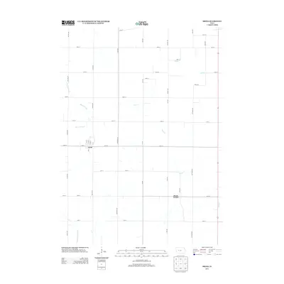
2013 Map of Breda
USGS Topo · Published 2013About this map
Breda serves as the primary hub in this portion of Carroll County, situated in a landscape defined by an extensive grid of agricultural section roads and the natural drainage patterns of the upper Raccoon River watershed. The town's layout is centered on Main St and a compact street grid including 1st St through 4th St, reflecting its character as a rural rail-era settlement. To the south, the village of Mount Carmel sits amidst rolling terrain where several small tributaries originate. Hydrological features are prominent throughout the quadrangle, notably the Wall Lake Inlet in the northwest and the Middle Raccoon River cutting through the southwest corner. The drainage network is further articulated by Storm Cr and Elk Run, which meander through the farmland between established north-south avenues like Granite Ave and Kittithawk Ave.
Find a feature on this map
40 named features on this map. Tap any name to fly to it.
Don’t see what you’re looking for? This feature index may not catch every label — zoom into the map to look around manually.
Map Details
Editions of this 2013 Breda Map
This is the sole edition of this map. No revisions or reprints were ever made.
Other maps of this area

1954 · Fort Dodge
USGS Topo · 1:250,000

1957 · Fort Dodge
USGS Topo · 1:250,000

1958 · Fort Dodge
USGS Topo · 1:250,000

1980 · Breda
USGS Topo · 1:24,000

1980 · Grant City
USGS Topo · 1:24,000

1980 · Carroll NE
USGS Topo · 1:24,000

1980 · Yetter
USGS Topo · 1:24,000

1980 · Lake View
USGS Topo · 1:24,000
1980 · Carroll West
USGS Topo · 1:24,000
1980 · Carroll East
USGS Topo · 1:24,000