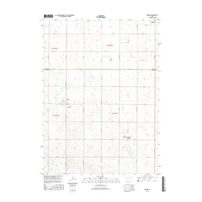
2015 Map of Breda
USGS Topo · Published 2015About this map
The settlement of Breda serves as the focal point for this 2015 survey of the northern Carroll County countryside, where the gridded farm roads typical of the Iowa landscape meet the winding headwaters of the Middle Raccoon River. To the southeast, the village of Mount Carmel is marked by significant local landmarks including Our Lady of Mount Carmel Cem and the Saint Bernards church and Saint Bernards Cem nearby. This map illustrates the transition from the upper reaches of the Raccoon River watershed to the drainage of Storm Cr and Elk Run in the north. The survey also captures a corner of Auburn at the edge of the Sac County line, providing a detailed view of the rural infrastructure connecting these communities, from the county highway network at Co Rd E26 to local corridors like Granite Ave and Yankee Ave.
Find a feature on this map
47 named features on this map. Tap any name to fly to it.
Don’t see what you’re looking for? This feature index may not catch every label — zoom into the map to look around manually.
Map Details
Editions of this 2015 Breda Map
This is the sole edition of this map. No revisions or reprints were ever made.
Other maps of this area

1954 · Fort Dodge
USGS Topo · 1:250,000

1957 · Fort Dodge
USGS Topo · 1:250,000

1958 · Fort Dodge
USGS Topo · 1:250,000

1980 · Breda
USGS Topo · 1:24,000

1980 · Grant City
USGS Topo · 1:24,000

1980 · Carroll NE
USGS Topo · 1:24,000

1980 · Yetter
USGS Topo · 1:24,000

1980 · Lake View
USGS Topo · 1:24,000
1980 · Carroll West
USGS Topo · 1:24,000
1980 · Carroll East
USGS Topo · 1:24,000