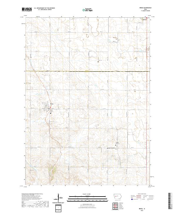
2022 Map of Breda
USGS Topo · Published 2022About this map
The town of Breda serves as the focal point of this western Iowa landscape, where the rectilinear grid of country roads meets the diagonal path of the Sauk Rail Trl. This corridor, following an old railroad grade, provides a distinct historical marker across the agricultural terrain of Carroll and Sac Counties. To the south, the village of Mount Carmel is situated near the Our Lady of Mount Carmel Cem, while the northern edge of the map reaches the outskirts of Auburn.
Find a feature on this map
45 named features on this map. Tap any name to fly to it.
Don’t see what you’re looking for? This feature index may not catch every label — zoom into the map to look around manually.
Map Details
Editions of this 2022 Breda Map
This is the sole edition of this map. No revisions or reprints were ever made.
Other maps of this area

1954 · Fort Dodge
USGS Topo · 1:250,000

1957 · Fort Dodge
USGS Topo · 1:250,000

1958 · Fort Dodge
USGS Topo · 1:250,000

1980 · Breda
USGS Topo · 1:24,000

1980 · Grant City
USGS Topo · 1:24,000

1980 · Carroll NE
USGS Topo · 1:24,000

1980 · Yetter
USGS Topo · 1:24,000

1980 · Lake View
USGS Topo · 1:24,000
1980 · Carroll West
USGS Topo · 1:24,000
1980 · Carroll East
USGS Topo · 1:24,000