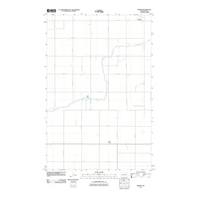
2011 Map of Bremen
USGS Topo · Published 2011About this map
James River meanders across this rural Wells County landscape, its course punctuated by the Sellie Dam as it flows toward the southeastern corner of the quadrangle. This area of North Dakota is defined by its methodical section-line road system, with routes such as 15th St NE and 51st Ave NE framing a terrain largely dedicated to agriculture. The settlement of Bremen serves as a focal point in the northern reaches, while the presence of the German Baptist Cemetery provides a tangible link to the community's ancestral roots and religious heritage. The interplay between the river's natural path and the rigid grid of the road network illustrates the 20th-century development of the Great Plains, where human engineering and historic burial sites remain primary landmarks in a sparsely populated region.
Find a feature on this map
20 named features on this map. Tap any name to fly to it.
Don’t see what you’re looking for? This feature index may not catch every label — zoom into the map to look around manually.
Map Details
Editions of this 2011 Bremen Map
This is the sole edition of this map. No revisions or reprints were ever made.
Other maps of this area

1932 · Flora
USGS Topo · 1:62,500

1943 · Maddock
USGS Topo · 1:62,500

1945 · Maddock
USGS Topo · 1:62,500

1948 · Cathay
USGS Topo · 1:62,500

1948 · Fessenden
USGS Topo · 1:62,500

1948 · Bremen
USGS Topo · 1:24,000

1949 · Bremen
USGS Topo · 1:24,000

1949 · Cathay
USGS Topo · 1:24,000

1949 · Cathay SE
USGS Topo · 1:24,000

1949 · Fessenden East
USGS Topo · 1:24,000