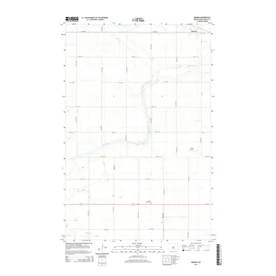
2014 Map of Bremen
USGS Topo · Published 2014About this map
The James River meanders across this rural section of Wells County, providing a natural focal point for the agricultural landscape around Bremen. This survey highlights the region's structured section-line road network, where routes like ND-15 and 52nd Ave NE divide the plains. Local history and genealogy interests are centered on the German Baptist Cem located along the highway. The presence of the Lill Strip Airport near the center of the quadrangle indicates the continued importance of private aviation for transport and crop management in this corner of the Great Plains. The map captures a transition in infrastructure, from county roads like CR-6 to the small residential cluster that defines the townsite.
Find a feature on this map
22 named features on this map. Tap any name to fly to it.
Don’t see what you’re looking for? This feature index may not catch every label — zoom into the map to look around manually.
Map Details
Editions of this 2014 Bremen Map
This is the sole edition of this map. No revisions or reprints were ever made.
Other maps of this area

1932 · Flora
USGS Topo · 1:62,500

1943 · Maddock
USGS Topo · 1:62,500

1945 · Maddock
USGS Topo · 1:62,500

1948 · Cathay
USGS Topo · 1:62,500

1948 · Fessenden
USGS Topo · 1:62,500

1948 · Bremen
USGS Topo · 1:24,000

1949 · Bremen
USGS Topo · 1:24,000

1949 · Cathay
USGS Topo · 1:24,000

1949 · Cathay SE
USGS Topo · 1:24,000

1949 · Fessenden East
USGS Topo · 1:24,000