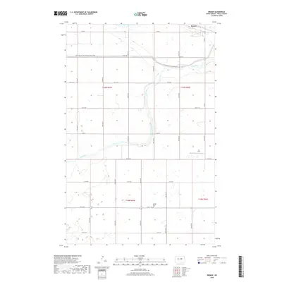
2018 Map of Bremen
USGS Topo · Published 2018About this map
James River meanders southward through the central plains of this North Dakota landscape, anchoring a rural topography defined by a rigid grid of section lines and county roads. Near the northern border, the small settlement of Bremen sits along the rail line, while the N Country National Scenic Trail cuts across the northern third of the map, following a path that parallels 22nd St NE before veering southeast toward the river. The area is characterized by numerous small prairie potholes and wetlands, common to the glaciated terrain of Wells County. In the southern portion of the quadrangle, the German Baptist Cem provides a specific point of interest for genealogists and local historians, situated alone among the agricultural plots. Farther east, the Lill Strip airfield represents the intersection of private aviation and remote prairie life.
Find a feature on this map
20 named features on this map. Tap any name to fly to it.
Don’t see what you’re looking for? This feature index may not catch every label — zoom into the map to look around manually.
Map Details
Editions of this 2018 Bremen Map
This is the sole edition of this map. No revisions or reprints were ever made.
Other maps of this area

1932 · Flora
USGS Topo · 1:62,500

1943 · Maddock
USGS Topo · 1:62,500

1945 · Maddock
USGS Topo · 1:62,500

1948 · Cathay
USGS Topo · 1:62,500

1948 · Fessenden
USGS Topo · 1:62,500

1948 · Bremen
USGS Topo · 1:24,000

1949 · Bremen
USGS Topo · 1:24,000

1949 · Cathay
USGS Topo · 1:24,000

1949 · Cathay SE
USGS Topo · 1:24,000

1949 · Fessenden East
USGS Topo · 1:24,000