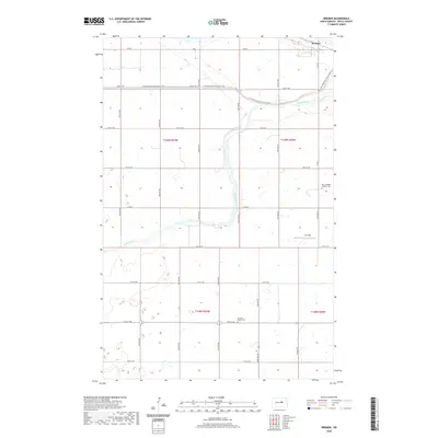
2020 Map of Bremen
USGS Topo · Published 2020About this map
Bremen sits in the northern reaches of Wells County, where the upper James River snakes through a landscape defined by the Public Land Survey System's rigid grid. This 2020 map documents a rural prairie environment where modern recreation and deep-rooted community history coexist. The N Country National Scenic Trail winds across the northern townships, cutting through the section lines of t149n r69w and t149n r68w. Local genealogy and historical settlement patterns are anchored by sites such as the Saint Josephs Catholic Cem in the east and the German Baptist Cem to the south. The map's detail reveals the sparse but intentional infrastructure of the North Dakota plains, from the small landing at Lill Strip to the network of numbered section roads like Co RD 5 and Co RD 6 that facilitate travel through this agricultural region.
Find a feature on this map
29 named features on this map. Tap any name to fly to it.
Don’t see what you’re looking for? This feature index may not catch every label — zoom into the map to look around manually.
Map Details
Editions of this 2020 Bremen Map
This is the sole edition of this map. No revisions or reprints were ever made.
Other maps of this area

1932 · Flora
USGS Topo · 1:62,500

1943 · Maddock
USGS Topo · 1:62,500

1945 · Maddock
USGS Topo · 1:62,500

1948 · Cathay
USGS Topo · 1:62,500

1948 · Fessenden
USGS Topo · 1:62,500

1948 · Bremen
USGS Topo · 1:24,000

1949 · Bremen
USGS Topo · 1:24,000

1949 · Cathay
USGS Topo · 1:24,000

1949 · Cathay SE
USGS Topo · 1:24,000

1949 · Fessenden East
USGS Topo · 1:24,000