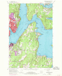
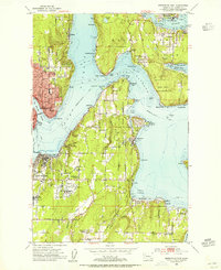
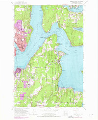
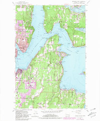
1953 Map of Bremerton East
USGS Topo · Published 1969About this map
Bainbridge Island and the Kitsap Peninsula shoreline define this mid-century coastal landscape, showing a maritime economy in transition as urban centers like Bremerton and Port Orchard expand. The survey details the strategic importance of the waterways, with the Fort Ward Naval Res and a large Naval Reservation occupying significant portions of the southern island and mainland. On the eastern shore of Port Orchard, small coastal settlements like Waterman, Colby, and Manchester line the reach of Rich Passage. Further south, the map identifies local community anchors including the Long Lake Community Church and Harper Church, while the Veterans Home (Retsil PO) overlooks Sinclair Inlet. These detailed records of school locations such as Sheridan Sch and cemeteries like Port Blakely Cemetery offer a precise view of the region's social geography before the late-century suburban surge.
Find a feature on this map
68 named features on this map. Tap any name to fly to it.
Don’t see what you’re looking for? This feature index may not catch every label — zoom into the map to look around manually.
Map Details
Editions of this 1953 Bremerton East Map
4 editions found
Other maps of this area

1894 · Seattle
USGS Topo · 1:62,500

1895 · Snohomish
USGS Topo · 1:125,000

1897 · Tacoma
USGS Topo · 1:125,000

1897 · Seattle
USGS Topo · 1:125,000

1900 · Tacoma
USGS Topo · 1:125,000

1908 · Seattle
USGS Topo · 1:62,500

1909 · Seattle Special
USGS Topo · 1:62,500

1937 · Port Orchard
USGS Topo · 1:62,500

1942 · Gig Harbor
USGS Topo · 1:62,500

1943 · Gig Harbor
USGS Topo · 1:62,500