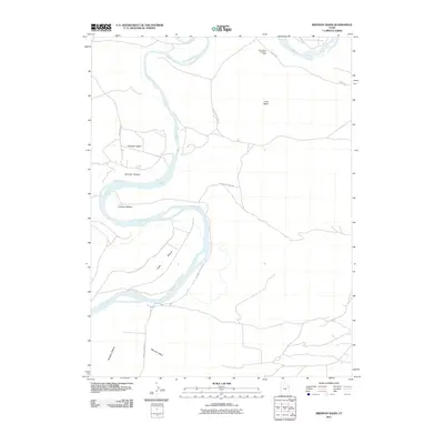
2011 Map of Brennan Basin
USGS Topo · Published 2011About this map
The Green River meanders through the heart of this landscape, carving a series of prominent river flats including Brennan Bottom, Johnson Bottom, and Leota Bottom. Located within the larger Uinta Basin, this territory is defined by the hydraulic action of the river and the industrial footprint of the Horseshoe Bend Oil Field in the northeast. The map illustrates a sparse network of access roads such as Wyasket Bottom Rd and Stirrup Rd, which serve the various petroleum extraction sites and navigate the transition from the river banks to the higher elevations of Brennan Basin. South of the main river bends, the terrain opens into Wonsits Valley, showing the distinct geological and industrial character of this portion of Uintah County.
Find a feature on this map
11 named features on this map. Tap any name to fly to it.
Don’t see what you’re looking for? This feature index may not catch every label — zoom into the map to look around manually.
Map Details
Editions of this 2011 Brennan Basin Map
This is the sole edition of this map. No revisions or reprints were ever made.
Other maps of this area

1885 · Ashley
USGS Topo · 1:250,000

1907 · Jensen
USGS Topo · 1:125,000

1910 · Jensen
USGS Topo · 1:125,000

1917 · Vernal
USGS Topo · 1:125,000

1954 · Vernal
USGS Topo · 1:250,000

1958 · Vernal
USGS Topo · 1:250,000

1960 · Vernal
USGS Topo · 1:250,000

1964 · Brennan Basin
USGS Topo · 1:24,000
1964 · Vernal SW
USGS Topo · 1:24,000
1964 · Ouray
USGS Topo · 1:24,000