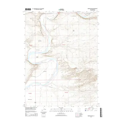
2014 Map of Brennan Basin
USGS Topo · Published 2014About this map
The Green River carves a winding path through this portion of the Uinta Basin, creating a series of dramatic alluvial flats and sharp bends. This landscape is defined by the hydrologic shifts of the river, which have formed distinct geographical areas such as Brennan Bottom, Johnson Bottom, and the expansive Leota Bottom. These bottomlands are critical features for both the local ecosystem and historical land use, with a portion of the map dedicated to a National Wildlife Refuge along the western riverbanks. Industrial activity is concentrated at the northern edge of the sheet within the Horseshoe Bend Oil Field, where the river makes a nearly complete loop known as Horseshoe Bend. The terrain transitions from these low-lying river plains into the higher, arid washes of Wonsits Valley, accessed by remote routes like Wonsits Valley Rd and Baeser Wash Rd.
Find a feature on this map
23 named features on this map. Tap any name to fly to it.
Don’t see what you’re looking for? This feature index may not catch every label — zoom into the map to look around manually.
Map Details
Editions of this 2014 Brennan Basin Map
This is the sole edition of this map. No revisions or reprints were ever made.
Other maps of this area

1885 · Ashley
USGS Topo · 1:250,000

1907 · Jensen
USGS Topo · 1:125,000

1910 · Jensen
USGS Topo · 1:125,000

1917 · Vernal
USGS Topo · 1:125,000

1954 · Vernal
USGS Topo · 1:250,000

1958 · Vernal
USGS Topo · 1:250,000

1960 · Vernal
USGS Topo · 1:250,000

1964 · Brennan Basin
USGS Topo · 1:24,000
1964 · Vernal SW
USGS Topo · 1:24,000
1964 · Ouray
USGS Topo · 1:24,000