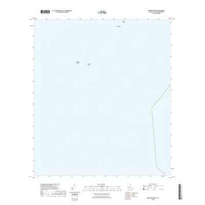
2018 Map of Breton Islands
USGS Topo · Published 2018About this map
The Breton Islands emerge from the Gulf of Mexico in this 2018 survey of the southern tip of Plaquemines Parish. This map documents a dynamic coastal environment where small landmasses like Breton and North Point represent some of the final outposts of the Mississippi River Delta's barrier island system. The prominence of West Point and its neighboring shoals reflects the shifting nature of these landforms, which are crucial for coastal protection and migratory bird habitats. Because the area is dominated by open water and tidal flats, the map serves as a primary record of the islands' exact footprint at this moment in time, showing the fragile relationship between the delta and the sea.
Find a feature on this map
4 named features on this map. Tap any name to fly to it.
Don’t see what you’re looking for? This feature index may not catch every label — zoom into the map to look around manually.
Map Details
Editions of this 2018 Breton Islands Map
This is the sole edition of this map. No revisions or reprints were ever made.
Other maps of this area

1893 · La Fortuna
USGS Topo · 1:62,500

1893 · Forts
USGS Topo · 1:62,500

1935 · Taylor Pass
USGS Topo · 1:31,680

1947 · Venice
USGS Topo · 1:31,680

1947 · Main Pass
USGS Topo · 1:31,680

1948 · Forts
USGS Topo · 1:62,500
1950 · Breton Islands
USGS Topo · 1:24,000

1953 · Breton Island
USGS Topo · 1:62,500
1954 · Venice
USGS Topo · 1:31,680
1954 · Taylor Pass
USGS Topo · 1:31,680