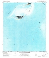
1971 Map of Breton Islands
USGS Topo · Published 1972About this map
The Breton National Wildlife Refuge dominates this coastal survey, preserving the fragile landforms of the Breton Islands at the edge of the Gulf of Mexico. These low-lying sandy barriers, including North Point and West Point, are seen here just as they appeared in the early 1970s, shaped by the currents of the Breton Sound. An interesting industrial contrast exists on this sheet, where the natural habitat meets the energy infrastructure of the Gulf. Numerous Oil Well locations and a designated Oil Field pepper the surrounding waters, while a Radio Tower and another Tower near the Mississippi River Gulf Outlet Canal mark the navigation and communication needs of the era. The orthophotomap style highlights the dynamic nature of these shifting shoals before decades of coastal erosion further altered their footprint.
Find a feature on this map
12 named features on this map. Tap any name to fly to it.
Don’t see what you’re looking for? This feature index may not catch every label — zoom into the map to look around manually.
Map Details
Editions of this 1971 Breton Islands Map
This is the sole edition of this map. No revisions or reprints were ever made.
Other maps of this area

1893 · La Fortuna
USGS Topo · 1:62,500

1893 · Forts
USGS Topo · 1:62,500

1935 · Taylor Pass
USGS Topo · 1:31,680

1947 · Venice
USGS Topo · 1:31,680

1947 · Main Pass
USGS Topo · 1:31,680

1948 · Forts
USGS Topo · 1:62,500
1950 · Breton Islands
USGS Topo · 1:24,000

1953 · Breton Island
USGS Topo · 1:62,500
1954 · Venice
USGS Topo · 1:31,680
1954 · Taylor Pass
USGS Topo · 1:31,680