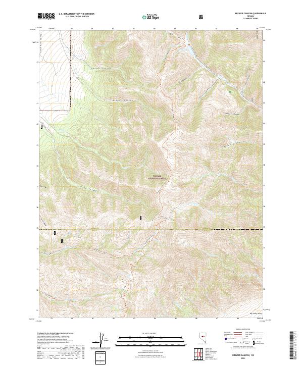
2021 Map of Brewer Canyon
USGS Topo · Published 2021About this map
Toiyabe National Forest dominates this high-elevation landscape, where the ridges of the Toiyabe Range separate the Reese River Valley to the west from the Big Smoky Valley to the east. The terrain is defined by a series of deep drainages including Porter Canyon, Brewer Canyon, and Kingston Canyon, which serve as the primary corridors through this steep vertical country. A network of primitive routes and recreational paths traverses the heights, most notably the Toiyabe Crest Natl Rec Trl, which follows the spine of the range near the prominent peak of Bunker Hill.
Find a feature on this map
41 named features on this map. Tap any name to fly to it.
Don’t see what you’re looking for? This feature index may not catch every label — zoom into the map to look around manually.
Map Details
Editions of this 2021 Brewer Canyon Map
This is the sole edition of this map. No revisions or reprints were ever made.
Other maps of this area

1955 · Millett
USGS Topo · 1:250,000

1956 · North Shoshone Peak
USGS Topo · 1:62,500

1956 · Millett Ranch
USGS Topo · 1:62,500

1956 · Austin
USGS Topo · 1:62,500

1959 · Millett
USGS Topo · 1:250,000

1969 · Dutch Flat
USGS Topo · 1:24,000

1985 · Smith Creek Valley
USGS Topo · 1:100,000
1988 · East of Millett Ranch
USGS Topo · 1:24,000
1988 · Bunker Hill
USGS Topo · 1:24,000
1988 · North Toiyabe Peak
USGS Topo · 1:24,000