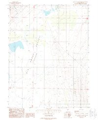
1988 Map of East of Millett Ranch
USGS Topo · Published 1988About this map
The Big Smoky Valley Depression dominates this desert landscape, characterized by its arid floor and a network of ephemeral basins. At the base of the Toiyabe National Forest, the terrain drops into expansive Alkali Flat regions where minerals accumulate from seasonal runoff. A prominent Salt pan and Aiken Creek illustrate the hydrologic patterns of central Nevada, where water travels from mountain canyons into these low-lying catchment areas. This provisional survey captures the area in the late 1980s, noting isolated landmarks like Hoodoo and a functional Well that signal the sparse human presence and the significance of water resources in this interior drainage basin.
Find a feature on this map
10 named features on this map. Tap any name to fly to it.
Don’t see what you’re looking for? This feature index may not catch every label — zoom into the map to look around manually.
Map Details
Editions of this 1988 East of Millett Ranch Map
This is the sole edition of this map. No revisions or reprints were ever made.
Other maps of this area

1907 · Tonopah
USGS Topo · 1:250,000

1908 · Tonopah
USGS Topo · 1:250,000

1926 · Roberts Mountains
USGS Topo · 1:250,000

1929 · Roberts Mountains
USGS Topo · 1:250,000

1955 · Millett
USGS Topo · 1:250,000

1956 · Millett Ranch
USGS Topo · 1:62,500

1956 · Tonopah
USGS Topo · 1:250,000

1959 · Tonopah
USGS Topo · 1:250,000

1959 · Millett
USGS Topo · 1:250,000

1960 · Wildcat Peak
USGS Topo · 1:62,500