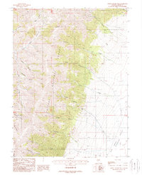
1988 Map of North Toiyabe Peak
USGS Topo · Published 1988About this map
North Toiyabe Peak stands as the central landmark of this high-elevation landscape within the Toiyabe National Forest. The map details the drainage systems and rugged topography of the Toiyabe Range during the late 1980s, where seasonal and perennial waters such as North Fork Birch Creek and Frenchman Creek carve deep canyons into the mountain flanks. Evidence of human activity is sparse but significant, including a Mine Shaft in the northeast and a Gravel Pit near the edge of the Smoky Depression. These features, along with names like Sawmill Canyon and Corral Canyon, suggest a history of resource extraction and livestock grazing. The transition from steep slopes to the alluvial fans of Big Valley is clearly defined, showing the network of 4WD trails that provided access to remote sites like Gilman Spring and the high ridges near Bunker Hill.
Find a feature on this map
31 named features on this map. Tap any name to fly to it.
Don’t see what you’re looking for? This feature index may not catch every label — zoom into the map to look around manually.
Map Details
Editions of this 1988 North Toiyabe Peak Map
This is the sole edition of this map. No revisions or reprints were ever made.
Other maps of this area

1926 · Roberts Mountains
USGS Topo · 1:250,000

1929 · Roberts Mountains
USGS Topo · 1:250,000

1955 · Millett
USGS Topo · 1:250,000

1956 · Millett Ranch
USGS Topo · 1:62,500

1956 · Austin
USGS Topo · 1:62,500

1959 · Millett
USGS Topo · 1:250,000

1960 · Spencer Hot Springs
USGS Topo · 1:62,500

1960 · Wildcat Peak
USGS Topo · 1:62,500

1978 · Summit Mountain
USGS Topo · 1:100,000

1985 · Smith Creek Valley
USGS Topo · 1:100,000