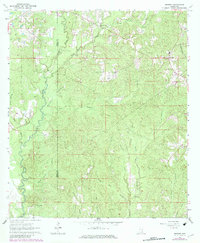
1963 Map of Brewer
USGS Topo · Published 1982About this map
Brewer and the Sand Hill community anchor this rural landscape in Greene County, Mississippi, during the early 1960s. The area is defined by a dense network of watercourses, including the north-flowing Piney Woods Creek and the southern reaches of Gaines Creek and Boykin Creek. The map documents a scattered settlement pattern typical of the era, where small country churches like Sand Hill Creek Ch and Zion Rest Ch served as central community landmarks alongside their respective burial grounds.
Find a feature on this map
34 named features on this map. Tap any name to fly to it.
Don’t see what you’re looking for? This feature index may not catch every label — zoom into the map to look around manually.
Map Details
Editions of this 1963 Brewer Map
4 editions found
Other maps of this area

1947 · Beaumont
USGS Topo · 1:62,500

1949 · Beaumont
USGS Topo · 1:62,500

1953 · Hattiesburg
USGS Topo · 1:250,000

1958 · Hattiesburg
USGS Topo · 1:250,000

1963 · Brewer
USGS Topo · 1:24,000

1964 · Rhodes
USGS Topo · 1:24,000

1964 · Richton
USGS Topo · 1:24,000

1964 · Mulberry
USGS Topo · 1:24,000

1964 · Avera
USGS Topo · 1:24,000

1964 · Piave
USGS Topo · 1:24,000