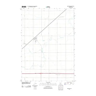
2010 Map of Brewster
USGS Topo · Published 2010About this map
The town of Brewster serves as the focal point of this southwestern Minnesota prairie landscape, situated where the railroad line bisects the agricultural grid. Local genealogy and history are well-preserved through several established grounds, including Trinity Cemetery, Hersey Cemetery, and Sacred Heart Cemetery, which cluster near the town center. The Brewster Post Office stands as a central landmark for the community's civic life. The surrounding terrain is defined by a hybrid of natural and engineered waterways, where the wandering paths of Okabena Creek and Elk Creek meet the straight, functional lines of drainage projects like Judicial Ditch Number Seventy-Six and Judicial Ditch Number Twenty-Eight. This configuration reflects a century of intensive land management used to support the region's productive farmstead economy.
Find a feature on this map
35 named features on this map. Tap any name to fly to it.
Don’t see what you’re looking for? This feature index may not catch every label — zoom into the map to look around manually.
Map Details
Editions of this 2010 Brewster Map
This is the sole edition of this map. No revisions or reprints were ever made.
Other maps of this area

1954 · Fairmont
USGS Topo · 1:250,000

1958 · Fairmont
USGS Topo · 1:250,000

1960 · Brewster
USGS Topo · 1:24,000

1960 · Okabena
USGS Topo · 1:24,000

1960 · Worthington North
USGS Topo · 1:24,000

1960 · Worthington South
USGS Topo · 1:24,000

1960 · Round Lake
USGS Topo · 1:24,000

1960 · Sioux Valley
USGS Topo · 1:24,000

1970 · Dundee
USGS Topo · 1:24,000

1970 · Fulda
USGS Topo · 1:24,000