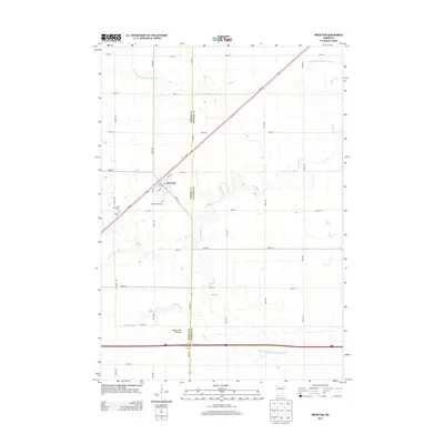
2013 Map of Brewster
USGS Topo · Published 2013About this map
Brewster serves as the primary focal point of this southwestern Minnesota prairie landscape, situated near the intersection of MN-60 and 10th St. The town is flanked by historic burial sites, including Sacred Heart Cem, Trinity Cem, and Hersey Cem, providing significant touchstones for local genealogical research. The surrounding terrain is part of the Coteau des Prairies, a high plateau characterized by a complex drainage network. This geography is defined by a system of managed watercourses such as Judicial Ditch Number Thirtyseven and Judicial Ditch Number Seventy-six, which augment natural features like Okabena Cr and Elk Cr. The map reveals a highly structured agricultural grid, where long avenues such as Wass Ave and Zeh Ave divide the land into productive sections.
Find a feature on this map
40 named features on this map. Tap any name to fly to it.
Don’t see what you’re looking for? This feature index may not catch every label — zoom into the map to look around manually.
Map Details
Editions of this 2013 Brewster Map
This is the sole edition of this map. No revisions or reprints were ever made.
Other maps of this area

1954 · Fairmont
USGS Topo · 1:250,000

1958 · Fairmont
USGS Topo · 1:250,000

1960 · Brewster
USGS Topo · 1:24,000

1960 · Okabena
USGS Topo · 1:24,000

1960 · Worthington North
USGS Topo · 1:24,000

1960 · Worthington South
USGS Topo · 1:24,000

1960 · Round Lake
USGS Topo · 1:24,000

1960 · Sioux Valley
USGS Topo · 1:24,000

1970 · Dundee
USGS Topo · 1:24,000

1970 · Fulda
USGS Topo · 1:24,000