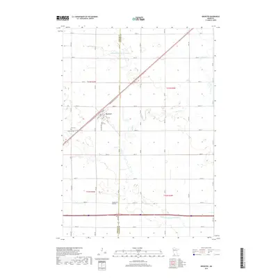
2019 Map of Brewster
USGS Topo · Published 2019About this map
The town of Brewster serves as the focal point of this southwestern Minnesota survey, situated along a prominent transportation corridor. The landscape is defined by the subtle rise of the Coteau des Prairies, a high glacial plateau that separates major drainage basins. This agricultural region is meticulously partitioned by a grid of rural roads such as Wass Ave and Zeh Ave, while the natural drainage provided by Okabena Cr and Elk Cr is supplemented by significant early-20th-century water management infrastructure, including Judicial Ditch Number Seventysix and Judicial Ditch Number Twentyeight. For those tracing local heritage, the map identifies several key burial sites on the western edge of the settlement, specifically Trinity Cem, Hersey Cem, and the Sacred Heart Cem. These sites, along with the defined township lines, illustrate the enduring social and religious organization of the prairie community.
Find a feature on this map
55 named features on this map. Tap any name to fly to it.
Don’t see what you’re looking for? This feature index may not catch every label — zoom into the map to look around manually.
Map Details
Editions of this 2019 Brewster Map
This is the sole edition of this map. No revisions or reprints were ever made.
Other maps of this area

1954 · Fairmont
USGS Topo · 1:250,000

1958 · Fairmont
USGS Topo · 1:250,000

1960 · Brewster
USGS Topo · 1:24,000

1960 · Okabena
USGS Topo · 1:24,000

1960 · Worthington North
USGS Topo · 1:24,000

1960 · Worthington South
USGS Topo · 1:24,000

1960 · Round Lake
USGS Topo · 1:24,000

1960 · Sioux Valley
USGS Topo · 1:24,000

1970 · Dundee
USGS Topo · 1:24,000

1970 · Fulda
USGS Topo · 1:24,000