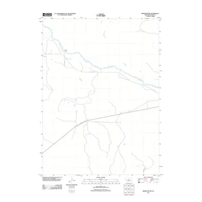
2011 Map of Brewster NW
USGS Topo · Published 2011About this map
The North Loup River meanders across this rural landscape in Blaine County, defining the drainage patterns and transportation routes of the region. This 2011 survey captures the area at a time when local travel relied on gravel and unimproved roads that followed the natural contours of the river valley. A primary crossing point is found at Pitt Bridge, where the river intersects with the local road network. Remote and sparsely populated, the territory is primarily connected by routes such as N Loup River Rd and W Milburn Rd, which link scattered ranching operations and agricultural lands. The map illustrates a classic Sandhills landscape where water and infrastructure are concentrated along the narrow river corridor, leaving the surrounding uplands largely undeveloped.
Find a feature on this map
5 named features on this map. Tap any name to fly to it.
Don’t see what you’re looking for? This feature index may not catch every label — zoom into the map to look around manually.
Map Details
Editions of this 2011 Brewster NW Map
This is the sole edition of this map. No revisions or reprints were ever made.
Other maps of this area

1949 · Koshopah
USGS Topo · 1:62,500

1951 · Dunning
USGS Topo · 1:62,500

1951 · Koshopah
USGS Topo · 1:62,500

1952 · Brewster
USGS Topo · 1:24,000

1952 · Brewster SE
USGS Topo · 1:24,000

1952 · Brewster SW
USGS Topo · 1:24,000

1952 · Brewster NW
USGS Topo · 1:24,000

1954 · North Platte
USGS Topo · 1:250,000

1955 · Broken Bow
USGS Topo · 1:250,000

1955 · O'Neill
USGS Topo · 1:250,000