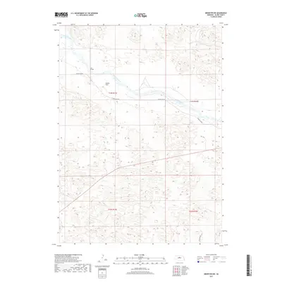
2017 Map of Brewster NW
USGS Topo · Published 2017About this map
The North Loup River winds through the northern reaches of this Blaine County landscape, creating a distinct riparian corridor through the Nebraska Sandhills. Near a bend in the river, the Pitt Bridge provides a vital crossing point, connecting local routes in an otherwise open ranching environment. South of the river, the level terrain of Hawley Flats stands out against the surrounding undulating topography, illustrating the varied grazing lands of the region. The map captures the sparse road network characteristic of this area, centered around W North Loup Rd and W Milburn Rd. This survey documents the rural character of the Nebraska interior during the early 21st century, highlighting the relationship between the river and the isolated infrastructure that supports the local agricultural community.
Find a feature on this map
9 named features on this map. Tap any name to fly to it.
Don’t see what you’re looking for? This feature index may not catch every label — zoom into the map to look around manually.
Map Details
Editions of this 2017 Brewster NW Map
This is the sole edition of this map. No revisions or reprints were ever made.
Other maps of this area

1949 · Koshopah
USGS Topo · 1:62,500

1951 · Dunning
USGS Topo · 1:62,500

1951 · Koshopah
USGS Topo · 1:62,500

1952 · Brewster
USGS Topo · 1:24,000

1952 · Brewster SE
USGS Topo · 1:24,000

1952 · Brewster SW
USGS Topo · 1:24,000

1952 · Brewster NW
USGS Topo · 1:24,000

1954 · North Platte
USGS Topo · 1:250,000

1955 · Broken Bow
USGS Topo · 1:250,000

1955 · O'Neill
USGS Topo · 1:250,000