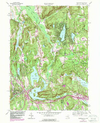
1958 Map of Brewster
USGS Topo · Published 1988About this map
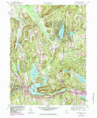
The East Branch Croton River anchors this landscape of critical New York City watershed infrastructure, where large reservoirs like Bog Brook Reservoir and Diverting Res dominate the valley floors. Settlement patterns follow the winding roads and the Conrail rail line, connecting established hubs like Brewster and Towners with smaller rural junctions such as Haines Corners, Sears Corners, and the curiously named Sodom. High ground is defined by peaks like Joes Hill and Browns Mtn, which separate the river valleys from the lake-dotted eastern edge of the quadrangle. Local genealogy interest is found in the scattered country churches and mill sites, including the Beaver Bog Ch in the northeast and the Geron Millpond, which reflect the area's transition from an agricultural and milling economy to a modern managed watershed.
Find a feature on this map
59 named features on this map. Tap any name to fly to it.
Don’t see what you’re looking for? This feature index may not catch every label — zoom into the map to look around manually.
Map Details
Editions of this 1958 Brewster Map
5 editions found
Other maps of this area

1892 · Danbury
USGS Topo · 1:62,500

1892 · New Milford
USGS Topo · 1:62,500

1892 · Carmel
USGS Topo · 1:62,500

1893 · Carmel
USGS Topo · 1:62,500

1893 · New Milford
USGS Topo · 1:62,500

1893 · Clove
USGS Topo · 1:62,500

1894 · Clove
USGS Topo · 1:62,500

1894 · Carmel
USGS Topo · 1:62,500

1898 · Clove
USGS Topo · 1:62,500

1901 · Clove
USGS Topo · 1:62,500