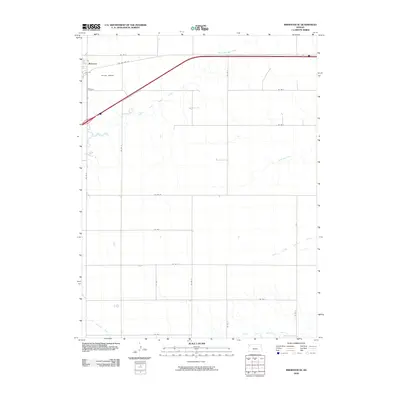
2009 Map of Brewster SE
USGS Topo · Published 2009About this map
Brewster anchors the northwest corner of this Thomas County landscape, where the town's grid meets the expansive agricultural section lines of Western Kansas. The area is defined by a series of parallel drainage systems, including the South Fork Sappa Creek and Prairie Dog Creek, which carve subtle paths through the high plains. Further south, the headwaters of the North Fork Solomon River and South Fork Solomon River emerge, illustrating the critical role this terrain plays in the hydrology of the Kansas River basin. Transportation history is visible in the alignment of Old US Hwy 24, which runs parallel to modern thoroughfares, while the Hutton Airport serves the local aviation needs of the rural community. The map provides a clear record of the rectilinear county road system, from Co Rd Q in the north to Co Rd I at the southern boundary, reflecting the organized land division typical of the era.
Find a feature on this map
22 named features on this map. Tap any name to fly to it.
Don’t see what you’re looking for? This feature index may not catch every label — zoom into the map to look around manually.
Map Details
Editions of this 2009 Brewster SE Map
This is the sole edition of this map. No revisions or reprints were ever made.
Other maps of this area

1943 · Colby
USGS Topo · 1:62,500

1954 · Goodland
USGS Topo · 1:250,000

1956 · Goodland
USGS Topo · 1:250,000

1957 · Goodland
USGS Topo · 1:250,000

1966 · Brewster NW
USGS Topo · 1:24,000

1966 · Brewster
USGS Topo · 1:24,000

1966 · Brewster SE
USGS Topo · 1:24,000

1967 · Brewster NE
USGS Topo · 1:24,000

1967 · Levant
USGS Topo · 1:24,000

1967 · Colby SW
USGS Topo · 1:24,000