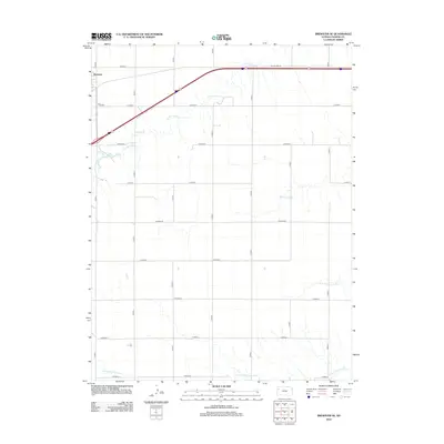
2012 Map of Brewster SE
USGS Topo · Published 2012About this map
Brewster anchors the northwest corner of this Thomas County landscape, where the High Plains terrain is etched by a series of parallel drainage systems. This 2012 survey illustrates the agricultural grid of the Kansas prairie, defined by a dense network of county roads from Co Road I to Co Road Q. The map reveals the intricate headwaters of several major regional waterways, including the S Fork Sappa Cr and Prairie Dog Cr in the north, and the N Fork Solomon River and S Fork Solomon River in the south. These intermittent streams cut through the section lines, dictating the local topography amidst a strictly ordered system of farm-to-market roads and the path of Old Us Hwy 24.
Find a feature on this map
22 named features on this map. Tap any name to fly to it.
Don’t see what you’re looking for? This feature index may not catch every label — zoom into the map to look around manually.
Map Details
Editions of this 2012 Brewster SE Map
This is the sole edition of this map. No revisions or reprints were ever made.
Other maps of this area

1943 · Colby
USGS Topo · 1:62,500

1954 · Goodland
USGS Topo · 1:250,000

1956 · Goodland
USGS Topo · 1:250,000

1957 · Goodland
USGS Topo · 1:250,000

1966 · Brewster NW
USGS Topo · 1:24,000

1966 · Brewster
USGS Topo · 1:24,000

1966 · Brewster SE
USGS Topo · 1:24,000

1967 · Brewster NE
USGS Topo · 1:24,000

1967 · Levant
USGS Topo · 1:24,000

1967 · Colby SW
USGS Topo · 1:24,000