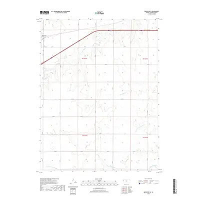
2018 Map of Brewster SE
USGS Topo · Published 2018About this map
Brewster anchors the northwest corner of this Thomas County landscape, where the High Plains terrain is etched by several major drainage systems. The map captures the headwaters of multiple significant regional waterways, including S Fork Sappa Cr, Prairie Dog Cr, and the north and south forks of the Solomon River. The transportation network is dominated by the modern Interstate 70 and US Route 24 corridors, which run parallel to the historic route of Old US Hwy 24. This transition from early highway travel to the interstate era is clearly visible in the path of the roads through the township and range sections. The territory remains characterized by its agricultural grid, defined by numerous county roads like Co Rd 2 and Co Rd P, which provide access to the vast open lands between the N Fork Solomon River and S Fork Solomon River.
Find a feature on this map
26 named features on this map. Tap any name to fly to it.
Don’t see what you’re looking for? This feature index may not catch every label — zoom into the map to look around manually.
Map Details
Editions of this 2018 Brewster SE Map
This is the sole edition of this map. No revisions or reprints were ever made.
Other maps of this area

1943 · Colby
USGS Topo · 1:62,500

1954 · Goodland
USGS Topo · 1:250,000

1956 · Goodland
USGS Topo · 1:250,000

1957 · Goodland
USGS Topo · 1:250,000

1966 · Brewster NW
USGS Topo · 1:24,000

1966 · Brewster
USGS Topo · 1:24,000

1966 · Brewster SE
USGS Topo · 1:24,000

1967 · Brewster NE
USGS Topo · 1:24,000

1967 · Levant
USGS Topo · 1:24,000

1967 · Colby SW
USGS Topo · 1:24,000